I collected the map data with a GPS. Feel free to download the map to Google Earth and make improvements. If you send me your updates, I'll publish them here and gladly give you the credit. My Gmail address is kenneth dot jones.
Hint: To view in 3D, be sure to enable 3D Terrain in Google Earth. Instructions here.
View/Edit Map in Google Earth (Get the free Google Earth here.) Just double-click the KMZ file and Google Earth will automatically import the trails and zoom to them.
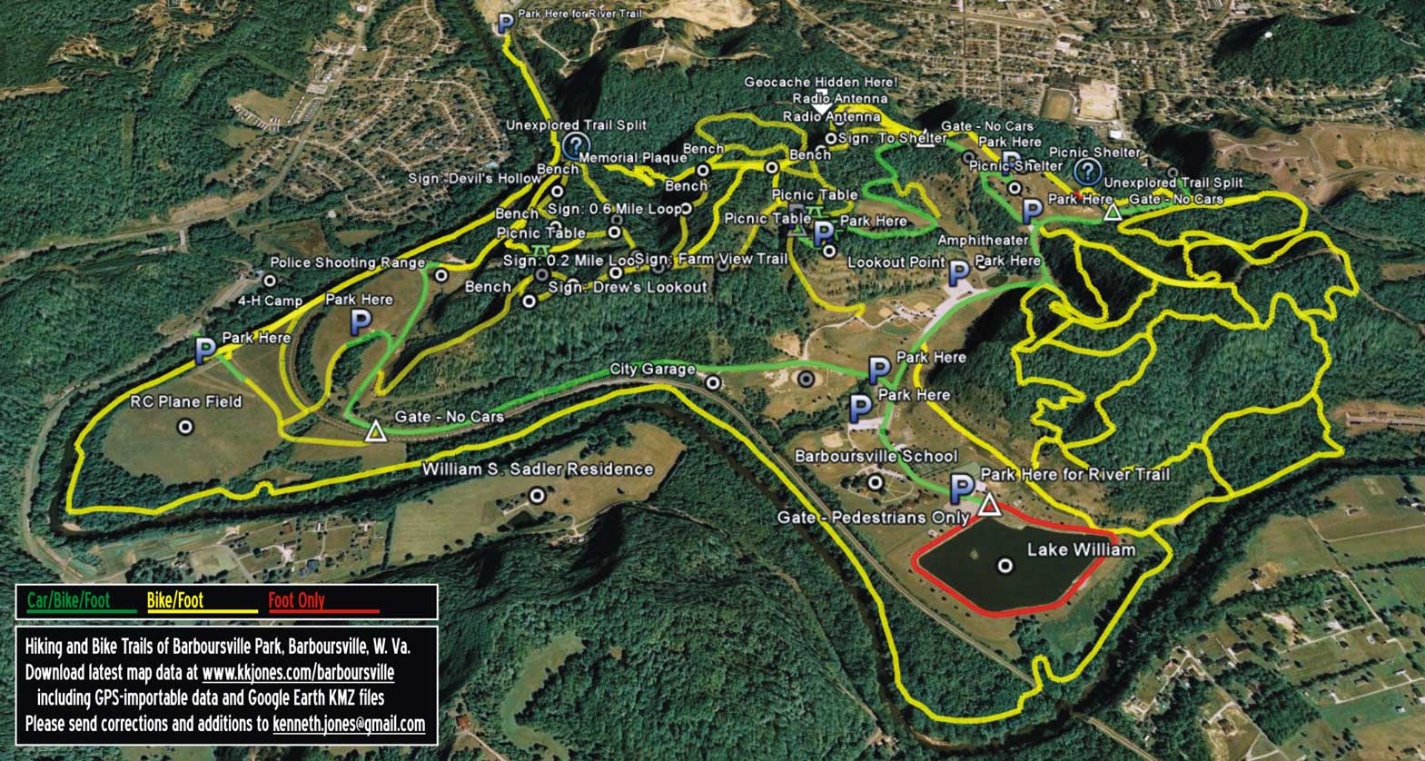
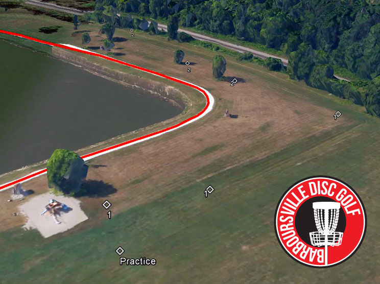
Barboursville Park map Features: Parking Spots for Bikers and Hikers (12), Park Benches (11), Trail Signs: Drew's Lookout, Devil's Hollow, Farm View Trail, 0.2 Mile Loop, 0.6 Mile Loop, Rest Stop, Radio Tower 0.6 Miles, To Shelter, Walking Trails 1 Mile, Vehicle Gates (5), Picnic Tables (3), Picnic Shelters (2), Radio Antennas (2), Unexplored Trails (2), Geocaches (1) Barboursville 4-H Camp, Lookout Point, Entrance to Park, Barboursville Police Department Shooting Range, Barboursville Soccer Fields, Barboursville City Garage, Barboursville Equestrian Facility, Lake William, Barboursville Amphitheater, Playground, Barboursville Remote Control Plane Field at 4-H Camp, William S. Sadler Residence. Barboursville also has a new 18-hole disc golf course. The first few holes are shown on the map below, but not on the above map above because of its small scale.
Other maps of mine:
Campsites and Trails at Boy Scout Camp Arrowhead, Ona, West Virginia
Barboursville Disc Golf, the city's 18-hole disc golf course,
designed by a three-time world disc golf champion.